Freelance
Cartographer | Geographer |
Gis Analyst
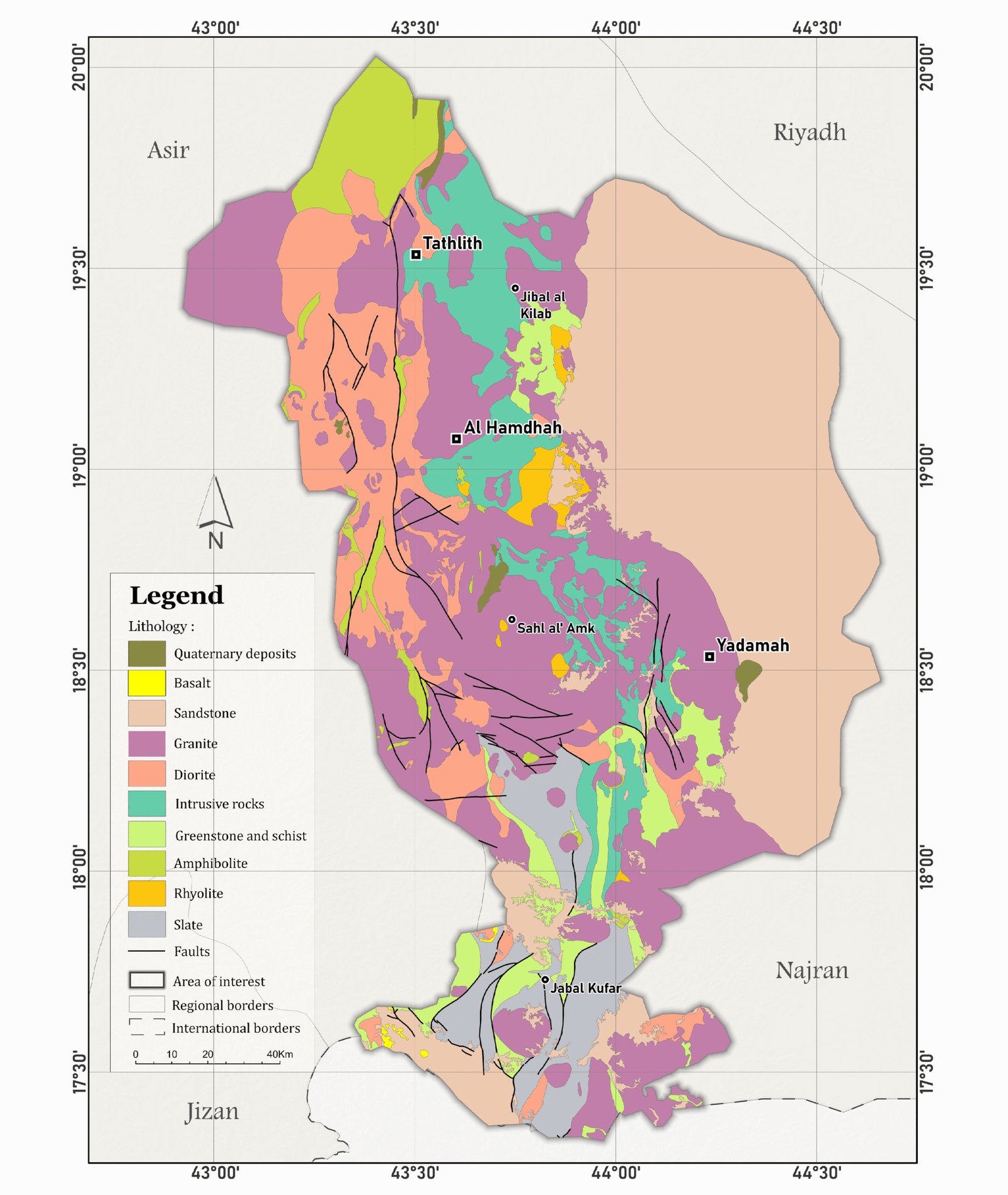
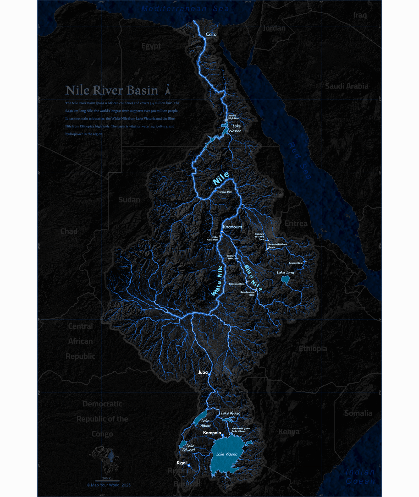
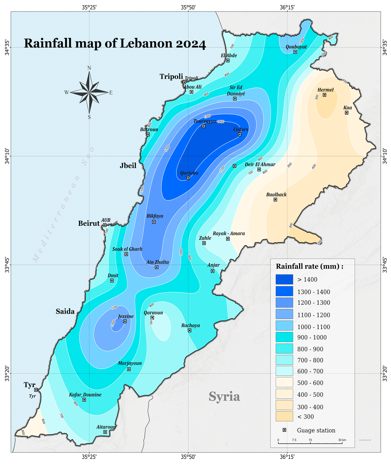
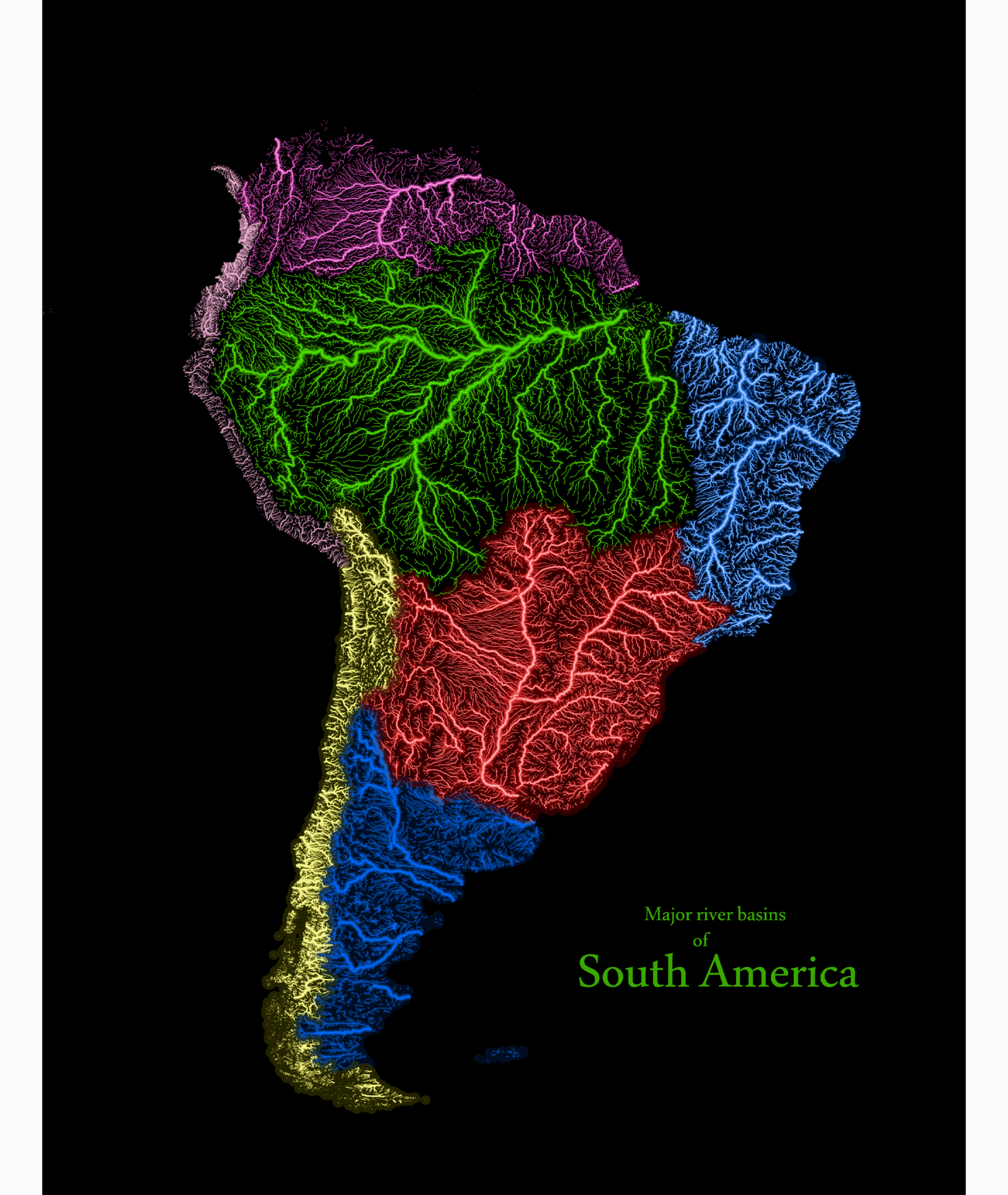
I’m a GIS analyst with a focus on hydrologic mapping, data analysis, and environmental studies. Skilled in ArcGIS Pro and geospatial data management, I contribute actionable insights for resource planning and development. Passionate about learning and making a meaningful impact.
Maps:
Map
0
+
Projects:
Project
0
+