Ali Abdallah - Portfolio
Ali Abdallah - Portfolio
Al Assi River Basin Study
This project focuses on the Al Assi River Basin, examining its physical and environmental characteristics through a set of thematic maps
Software Used: ArcGIS Pro
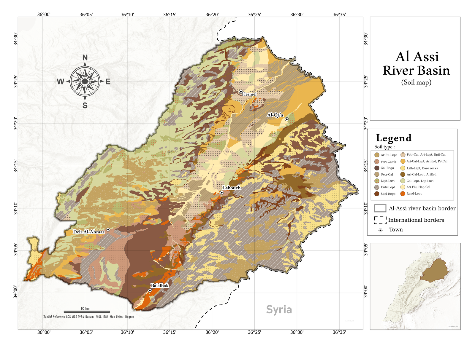
This map illustrates the soil distribution within the Al Assi River Basin
This map illustrates the soil distribution within the Al Assi River Basin
Al Assi River Basin Study
This project focuses on the Al Assi River Basin, examining its physical and environmental characteristics through a set of thematic maps
Software Used: ArcGIS Pro
Actual evapotranspiration in Al Assi river basin
This map presents the spatial variation of Actual evapotranspiration across the Al Assi River Basin.
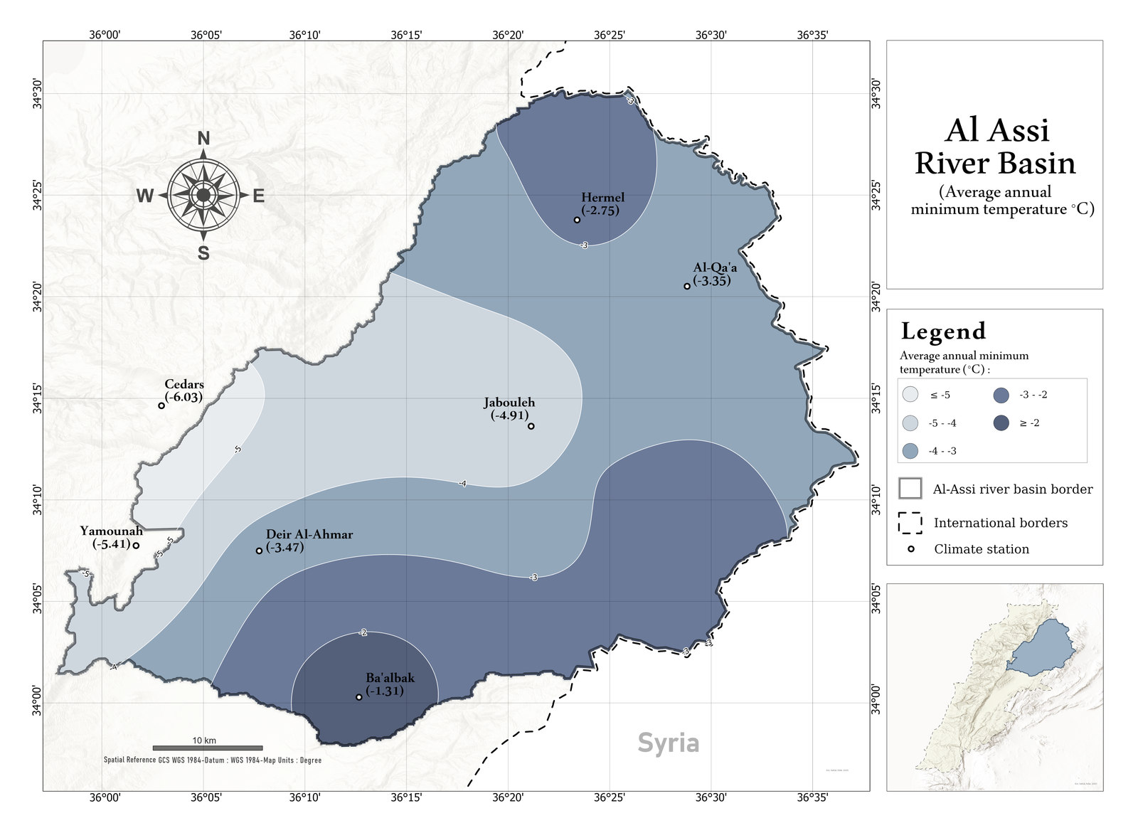
Average annual minimum temperature in Al Assi river basin
This map presents the spatial variation of average annual minimum temperature across the Al Assi River Basin.
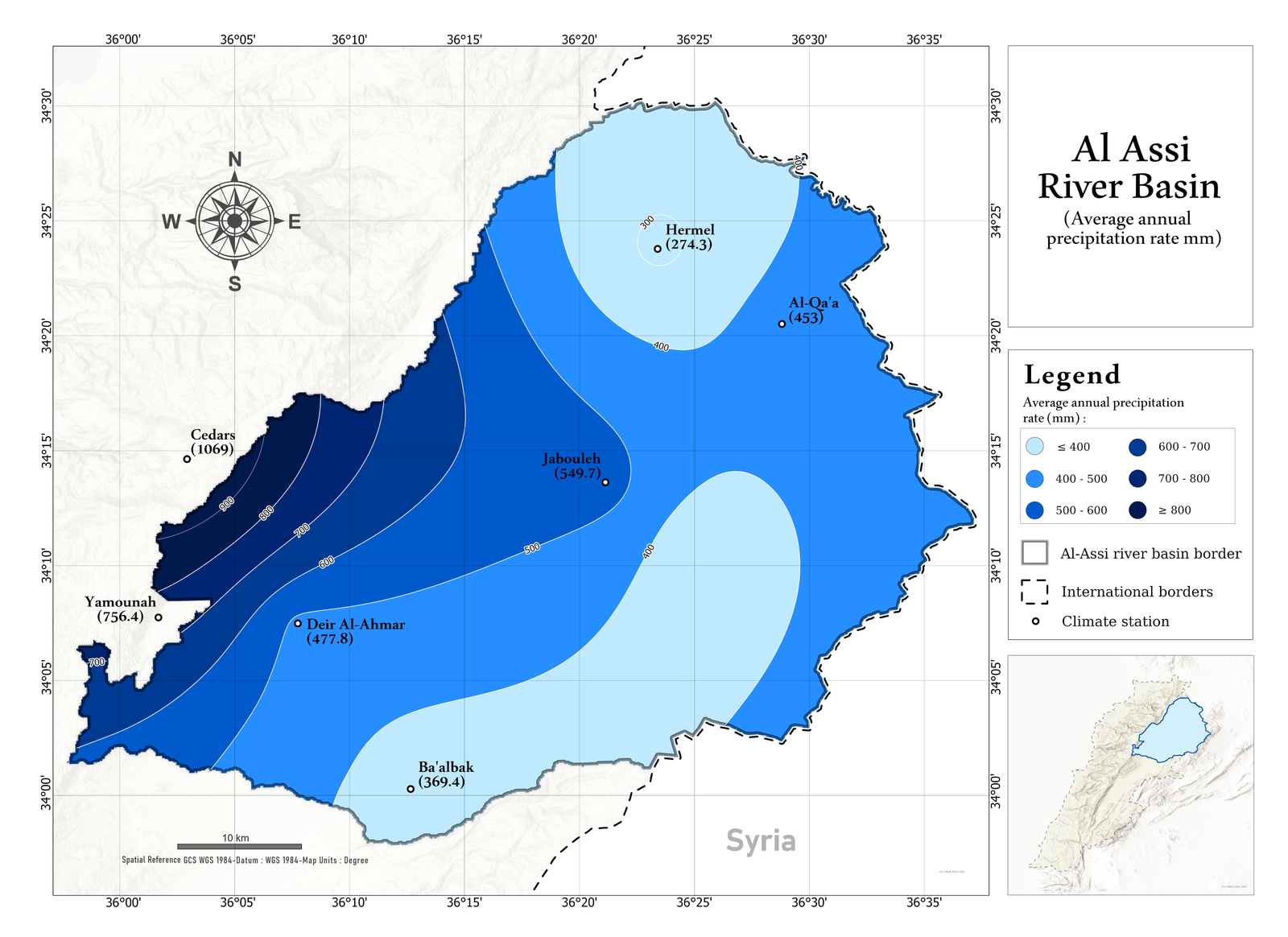
Average annual precipitation rate in Al Assi river basin
This map illustrates the spatial distribution of average annual precipitation in the Al Assi River Basin..
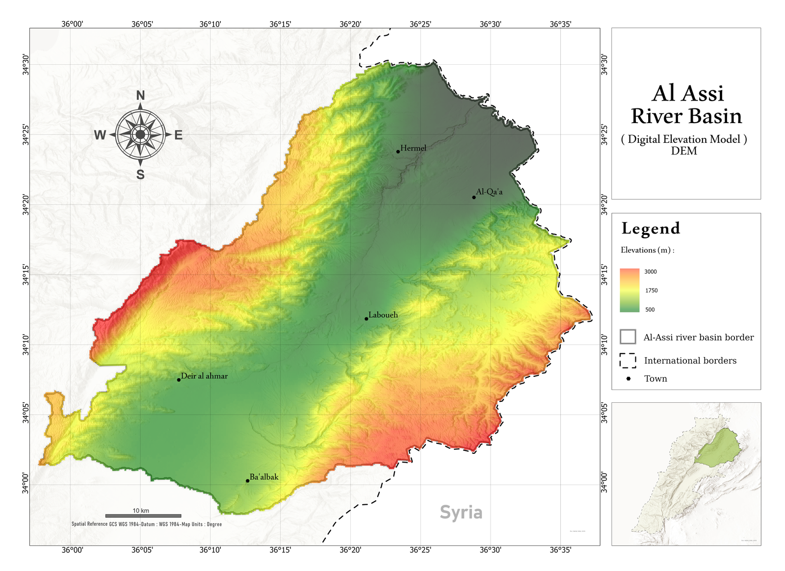
Elevations in Al Assi river basin
This map shows the elevation distribution across the Al Assi River Basin using a Digital Elevation Model (DEM), showing the terrain variation and topographic features.
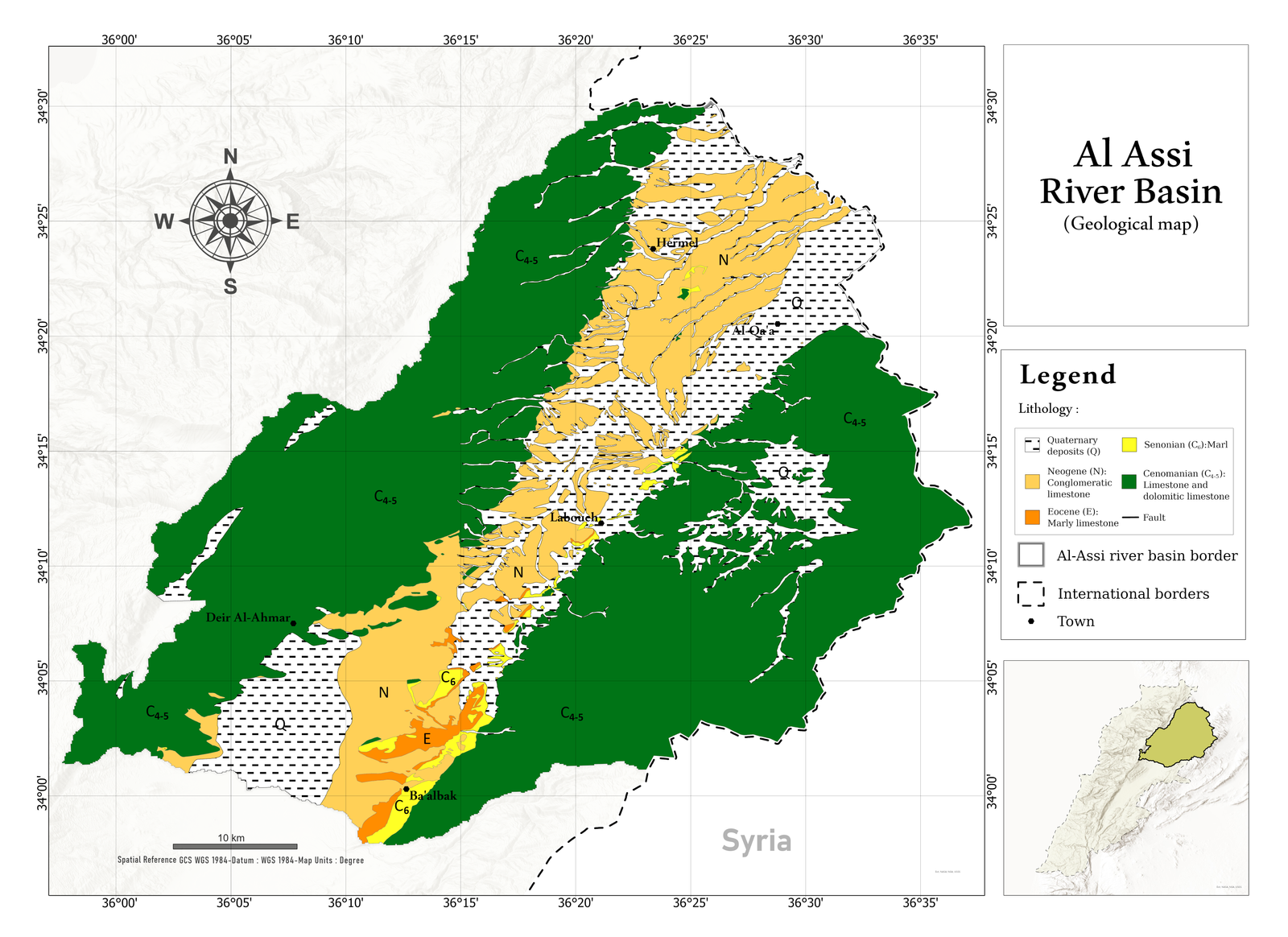
Geology in Al Assi river basin
This map presents the lithological units and fault lines within the Al Assi River Basin.
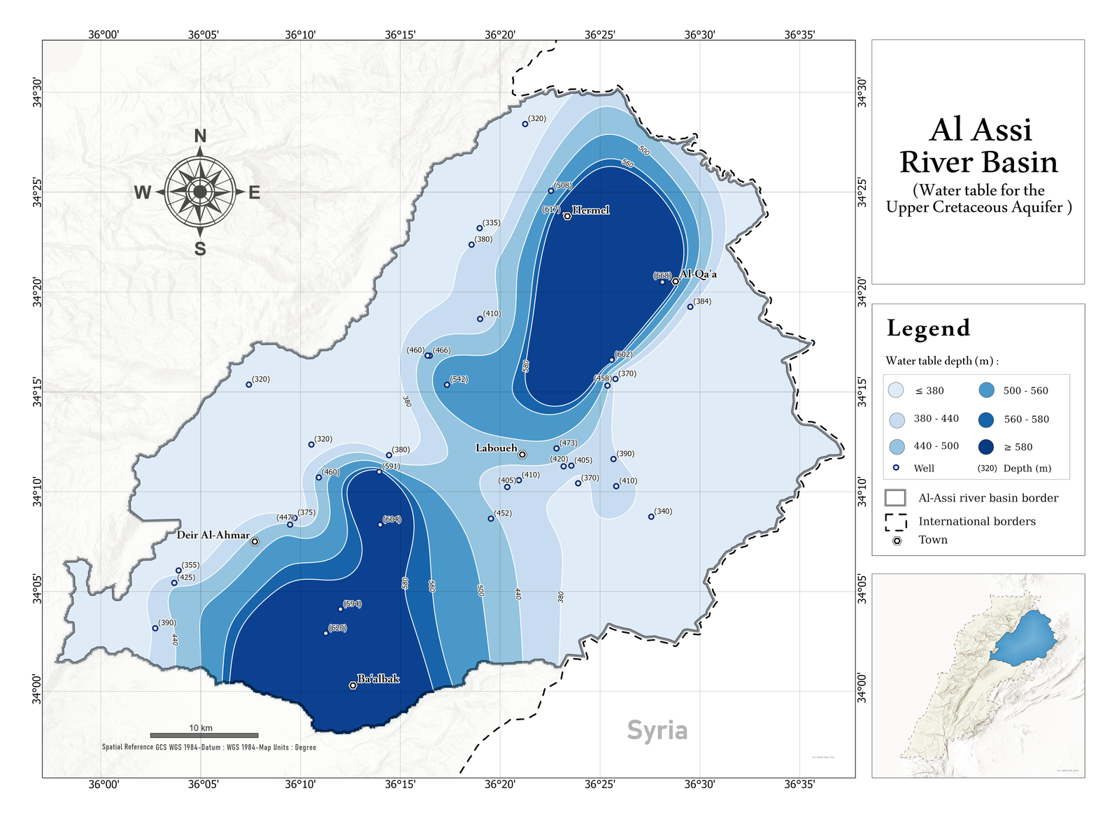
Water table for the upper cretaceous aquifer in Al Assi river basin
This map shows the spatial distribution of groundwater depth within the Upper Cretaceous aquifer of the Al Assi River Basin.
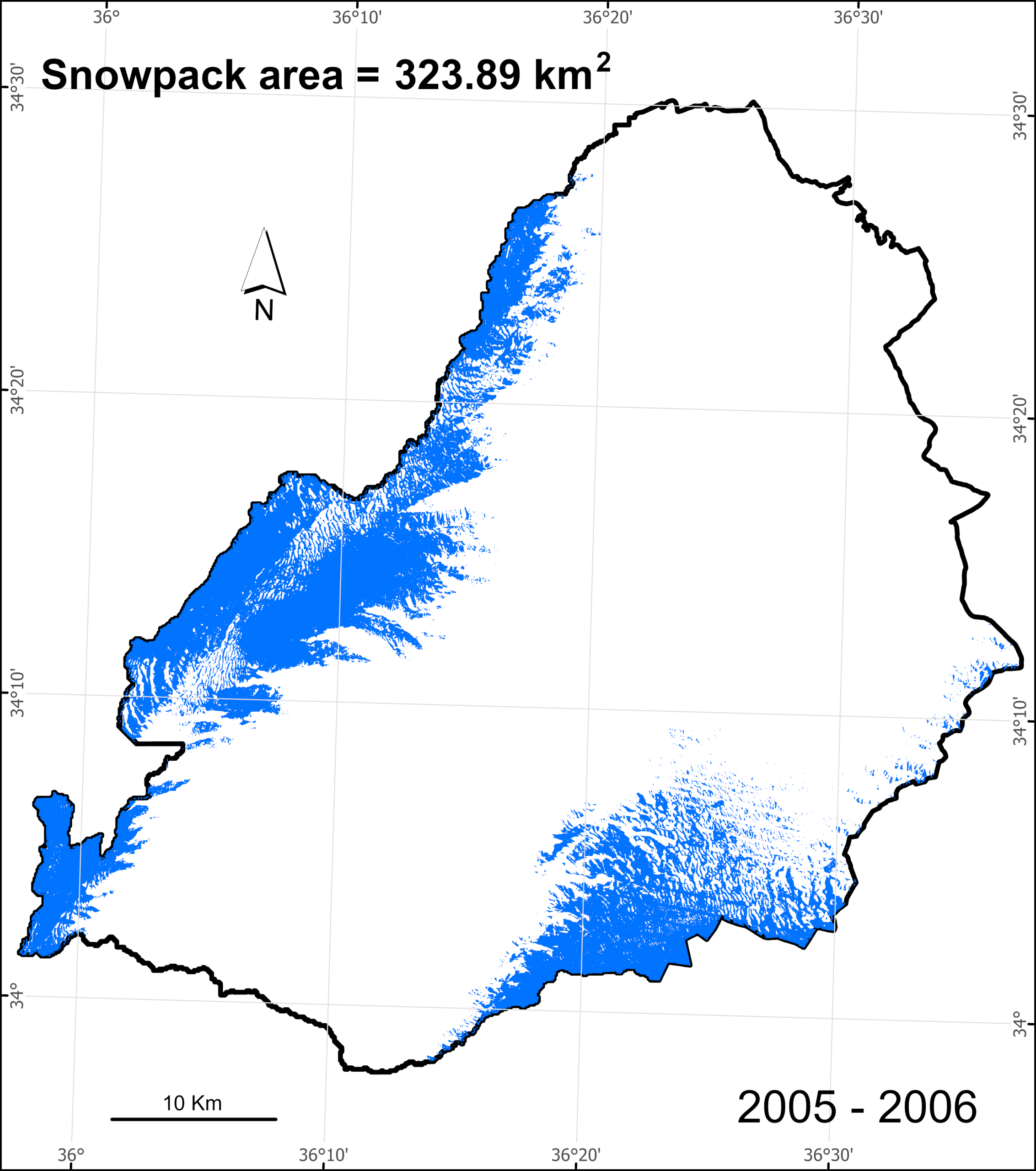
Snow pack of Al Assi river basin 2005-2025.
This project illustrates the spatial and temporal variation of snowpack in the Al Assi River Basin from 2005 to 2025, derived from Landsat 7 and Landsat 8 satellite imagery using Google Earth Engine.
Actual Evapotranspiration in Al Assi river basin 2018-2024.
This project ilustrates the spatial and temporal variation of actual evaporation in the Al Assi River Basin from 2018 to 2024. The data were derived from remote sensing sources and processed as raster datasets in ArcGIS Pro.