Ali Abdallah - Portfolio
Geographic Information System Specialist - 10/2021 to Present
The Lebanese Center for Water and Environment · Freelance, Beirut, Lebanon
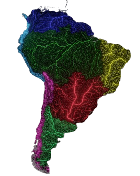
I manage and interpret both raster and vector data to create detailed hydrologic maps that enhance understanding of water resources and environmental conditions. I conduct thorough hydrologic mapping and data analysis to support effective water resource management and contribute to comprehensive environmental studies.
By employing advanced GIS techniques, I analyze hydrologic datasets to produce insightful visualizations that assist stakeholders in making informed decisions. Leveraging cutting-edge geospatial technology, I deliver accurate and detailed data visualizations, ensuring stakeholders have access to relevant information for planning and management. I collaborate with governmental and non-governmental organizations to identify specific data needs and develop tailored GIS solutions that meet project goals.
Additionally, I maintain and regularly update GIS databases to ensure data accuracy, accessibility, and reliability for ongoing projects. I prepare reports and presentations that clearly communicate findings, methodologies, and recommendations, making complex data accessible to diverse audiences.
To continuously enhance my skills, I stay updated on the latest trends and advancements in GIS technologies, improving analytical capabilities and methodologies used in my projects.