Ali Abdallah - Portfolio
Ali Abdallah - Portfolio
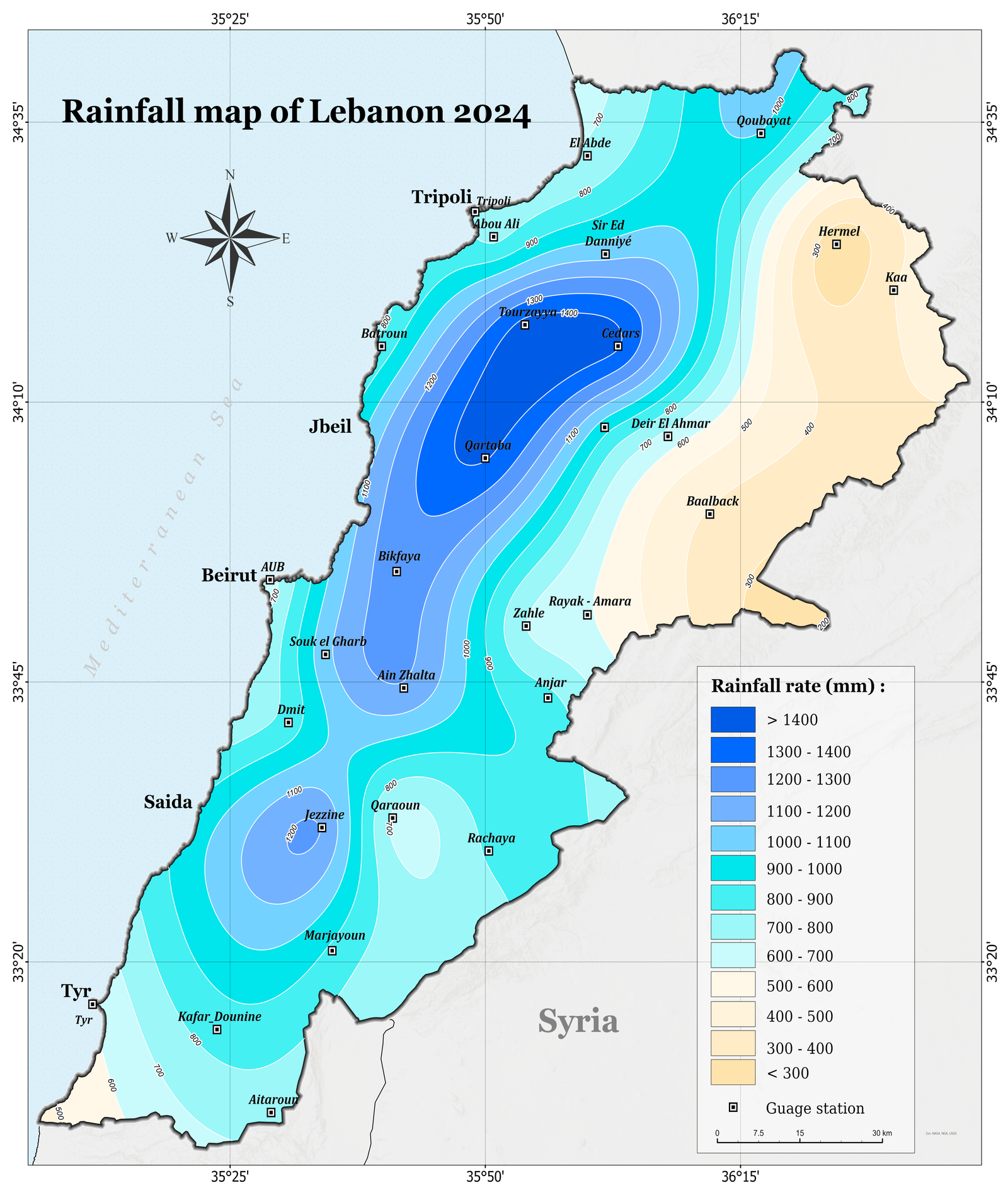
Rainfall Map of Lebanon – 2024
This map illustrates the spatial distribution of annual rainfall across Lebanon for the year 2024. It was developed using spatial analysis techniques in ArcGIS Pro and integrates point data from meteorological gauge stations.
Rainfall Map of Lebanon – 2024
This map illustrates the spatial distribution of annual rainfall across Lebanon for the year 2024. It was developed using spatial analysis techniques in ArcGIS Pro and integrates point data from meteorological gauge stations.