This project presents a collection of maps, including relief maps and city road maps, with spatial data prepared in ArcGIS Pro and the final visualizations created in Blender, providing clear and intuitive representations of terrain and urban features.
This project presents a collection of maps, including relief maps and city road maps, with spatial data prepared in ArcGIS Pro and the final visualizations created in Blender, providing clear and intuitive representations of terrain and urban features.
Software Used: ArcGIS Pro
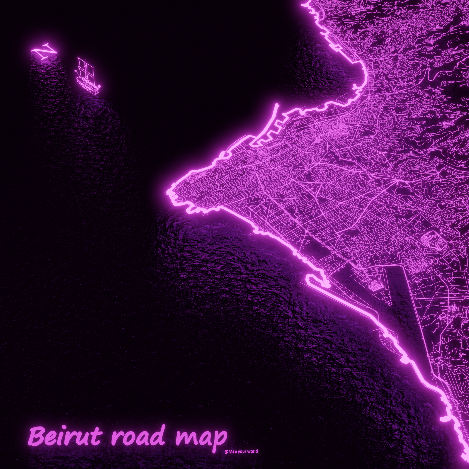
Beirut road map
This map illustrates the roads of Beirut using lighting lines.
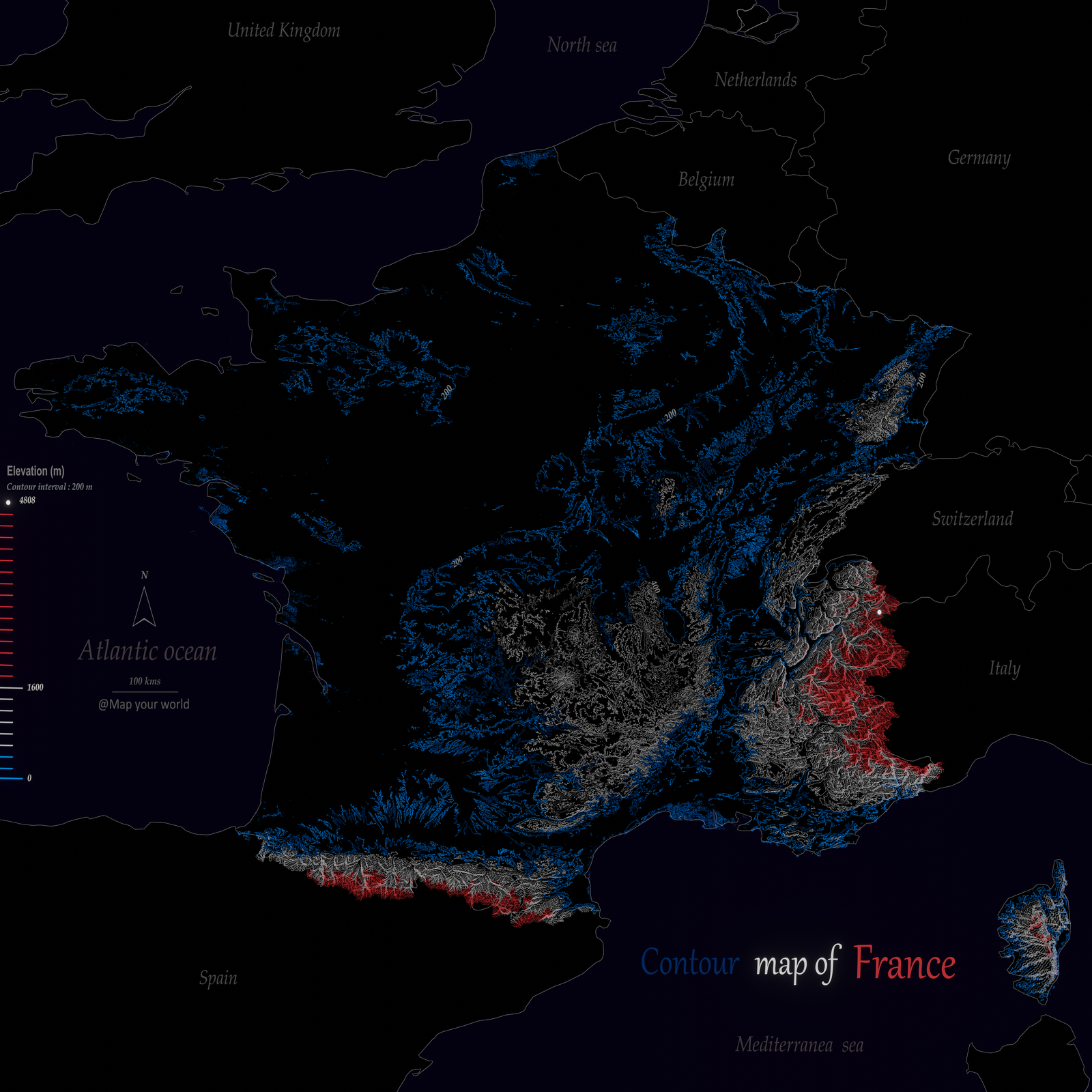
Contour map of France
This map illustrates the relief of France using contour lines.
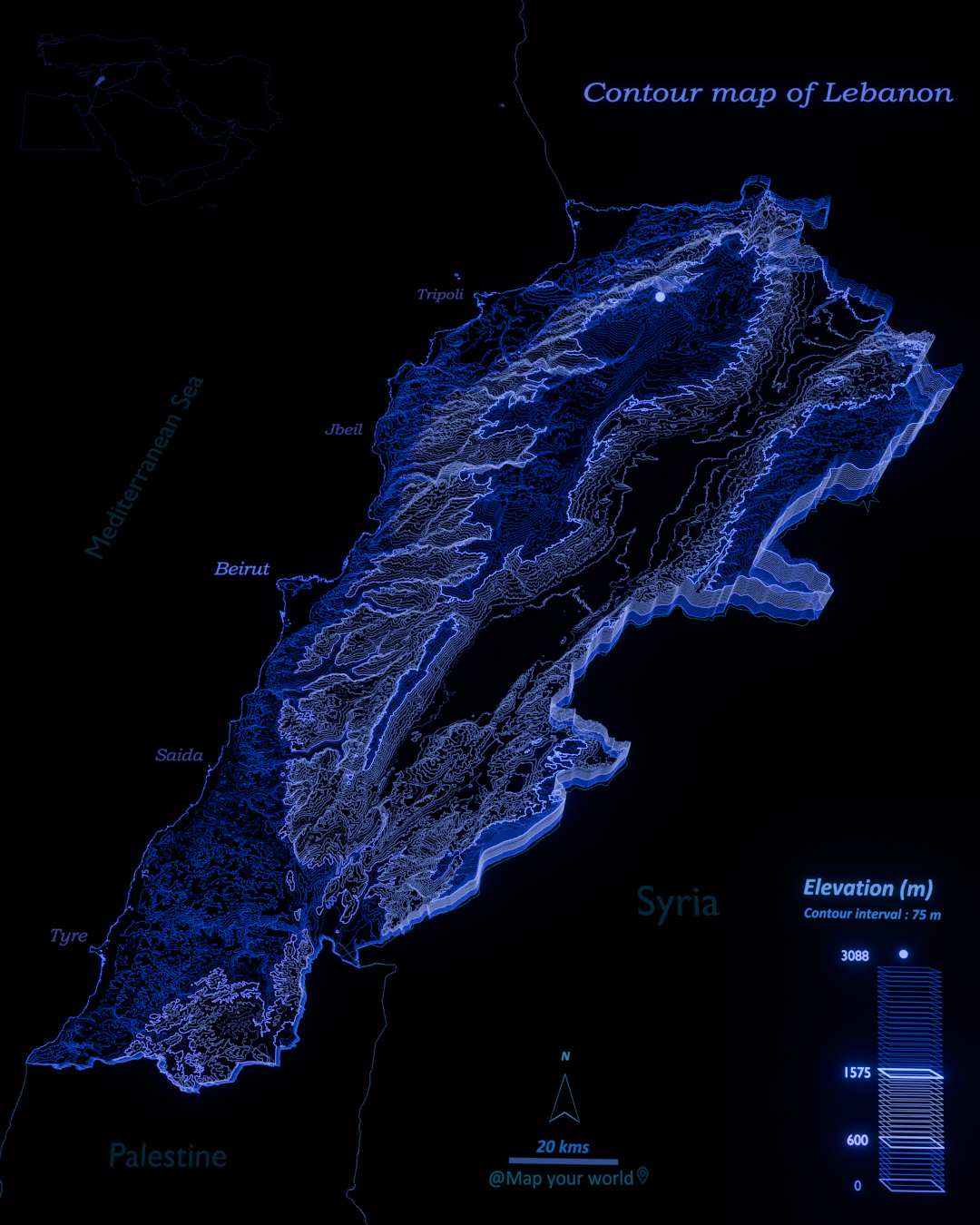
Contour map of Lebanon
This map illustrates the relief of Lebanon using contour lines.
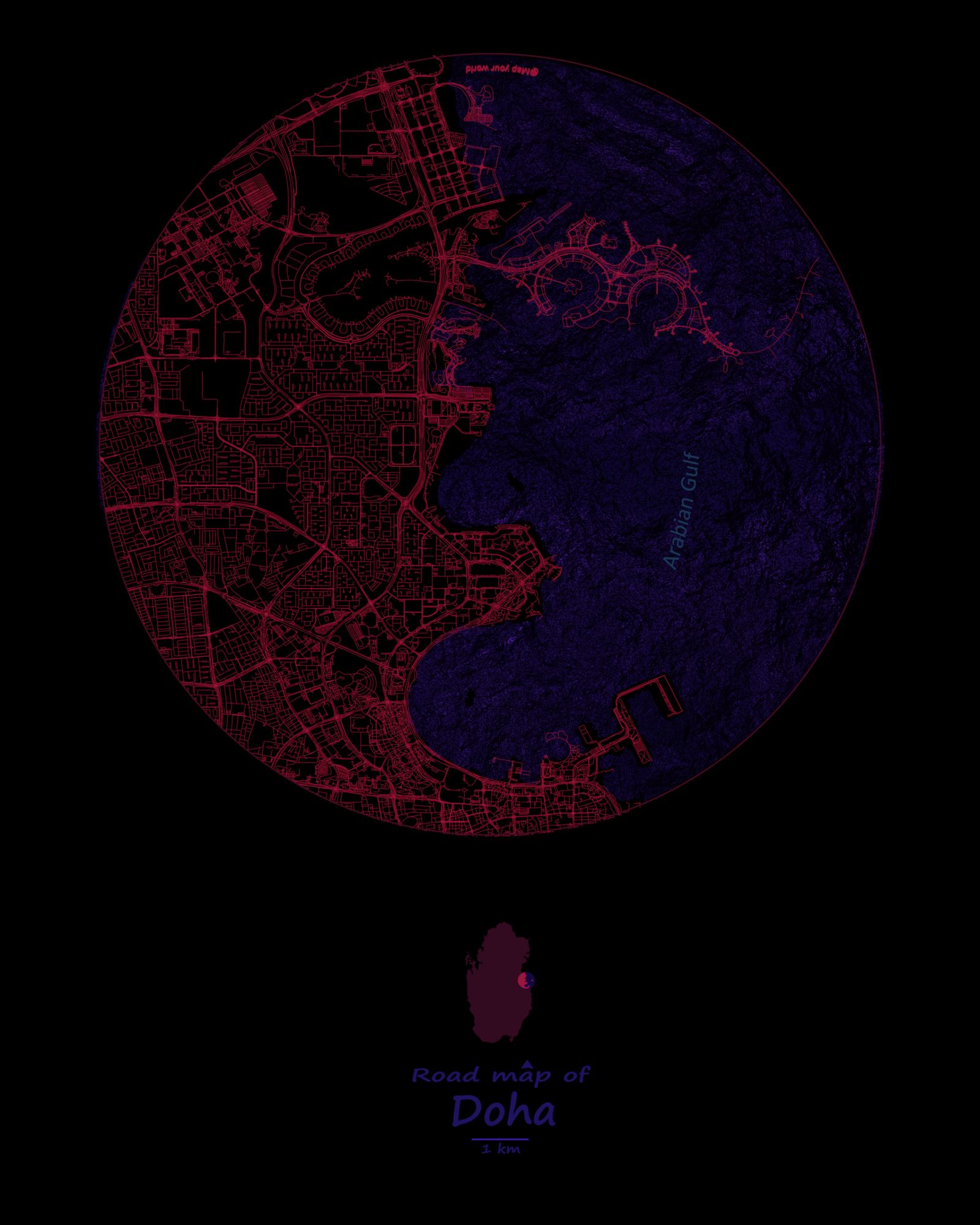
Doha road map
This map illustrates the roads of Doha using lighting lines.
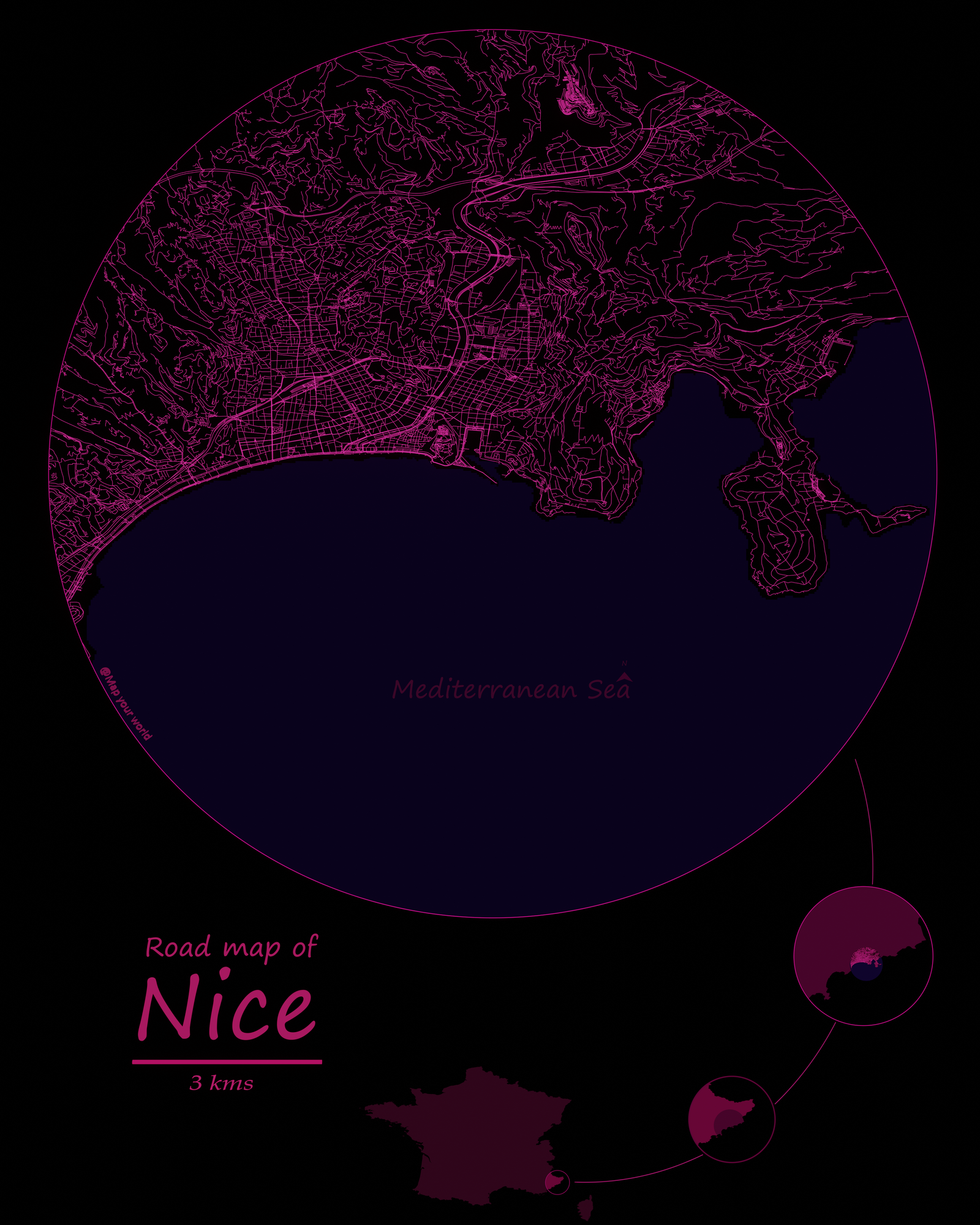
Nice road map
This map illustrates the roads of Nice using lighting lines.
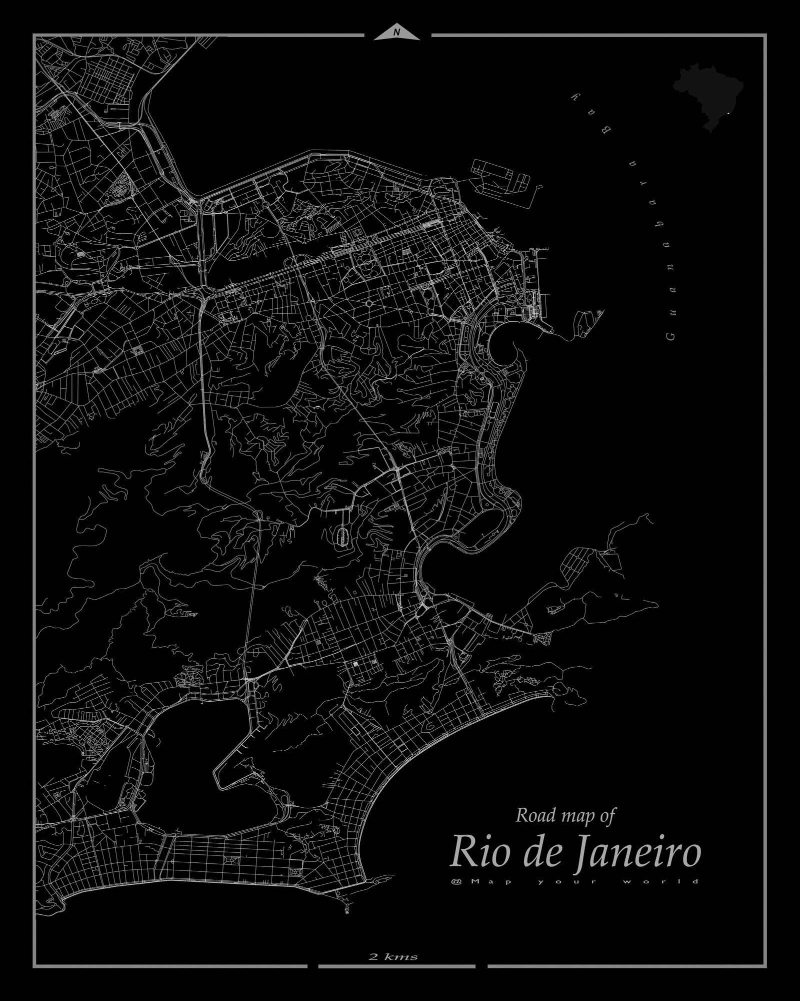
Rio de Janeiro road map
This map illustrates the roads of Rio de Janeiro using lighting lines.