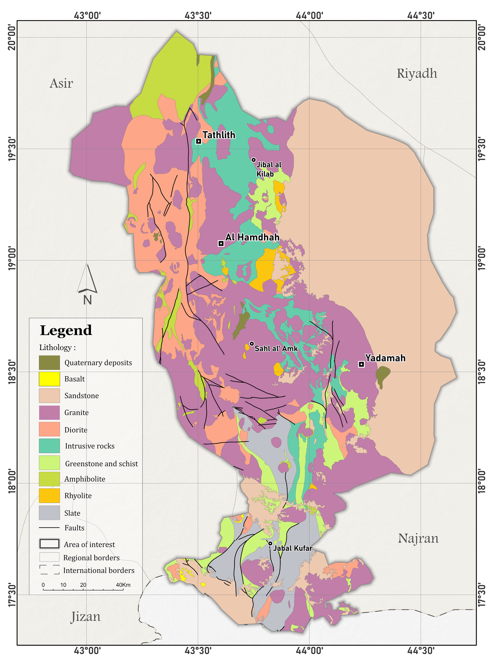
This map illustrates the geology of the Tathlith region in Saudi Arabia, showing the distribution of different lithological units and structural features across the area.
Digitizing and Symbolizing maps in Tathlith region, Saudi Arabia.
Software Used: ArcGIS Pro
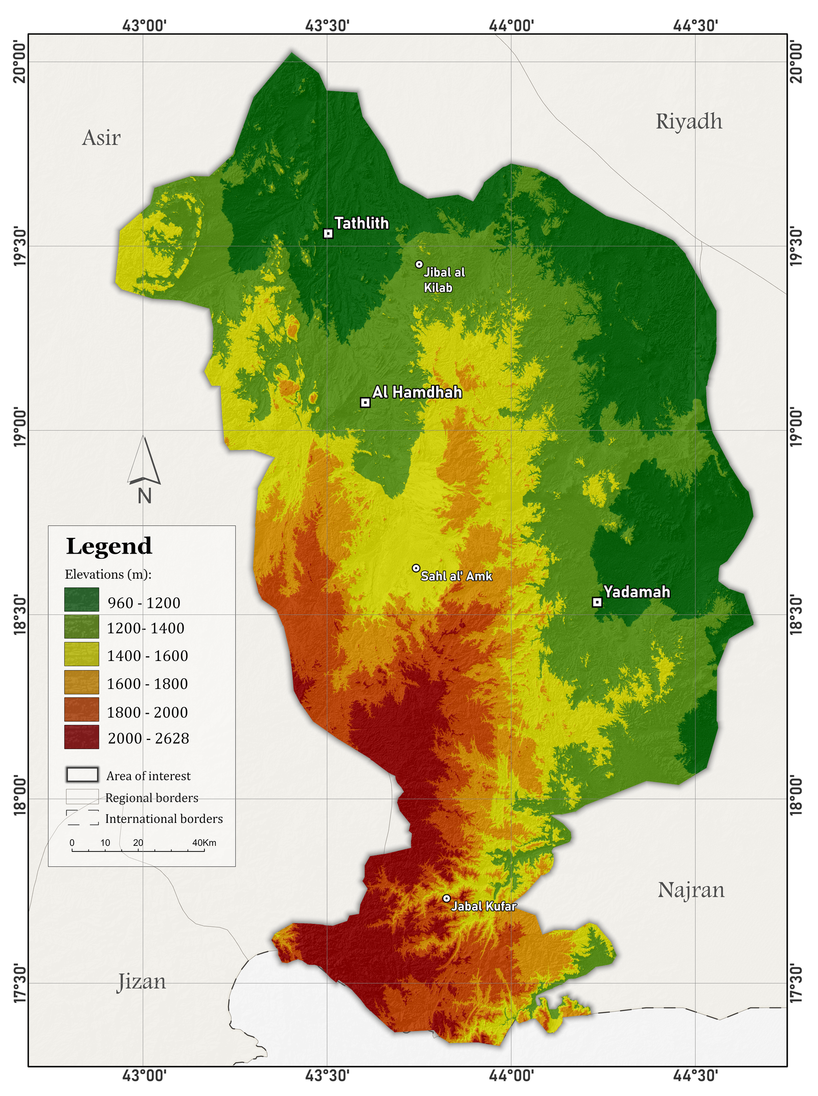
Elevations map of Tathlith region,Saudi Arabia
This map illustrates the spatial distribution of elevations in the Tathlith region of Saudi Arabia. The elevation values (in meters) were classified and visualized in ArcGIS Pro to highlight variations in topography across the area.
Actual Evapotranspiration Map – Tathlith region, Saudi Arabi 2024
Actual Evapotranspiration map of Tathlith region, Saudi Arabi
This map illustrates the spatial distribution of actual evapotranspiration (AET) in the Tathlith region of Saudi Arabia for the year 2024. The AET values (in mm/year) were processed and visualized in ArcGIS Pro using classified symbology to highlight areas of varying water loss through soil evaporation and plant transpiration.
Actual Evapotranspiration map – Tathlith Region, Saudi Arabia 2024
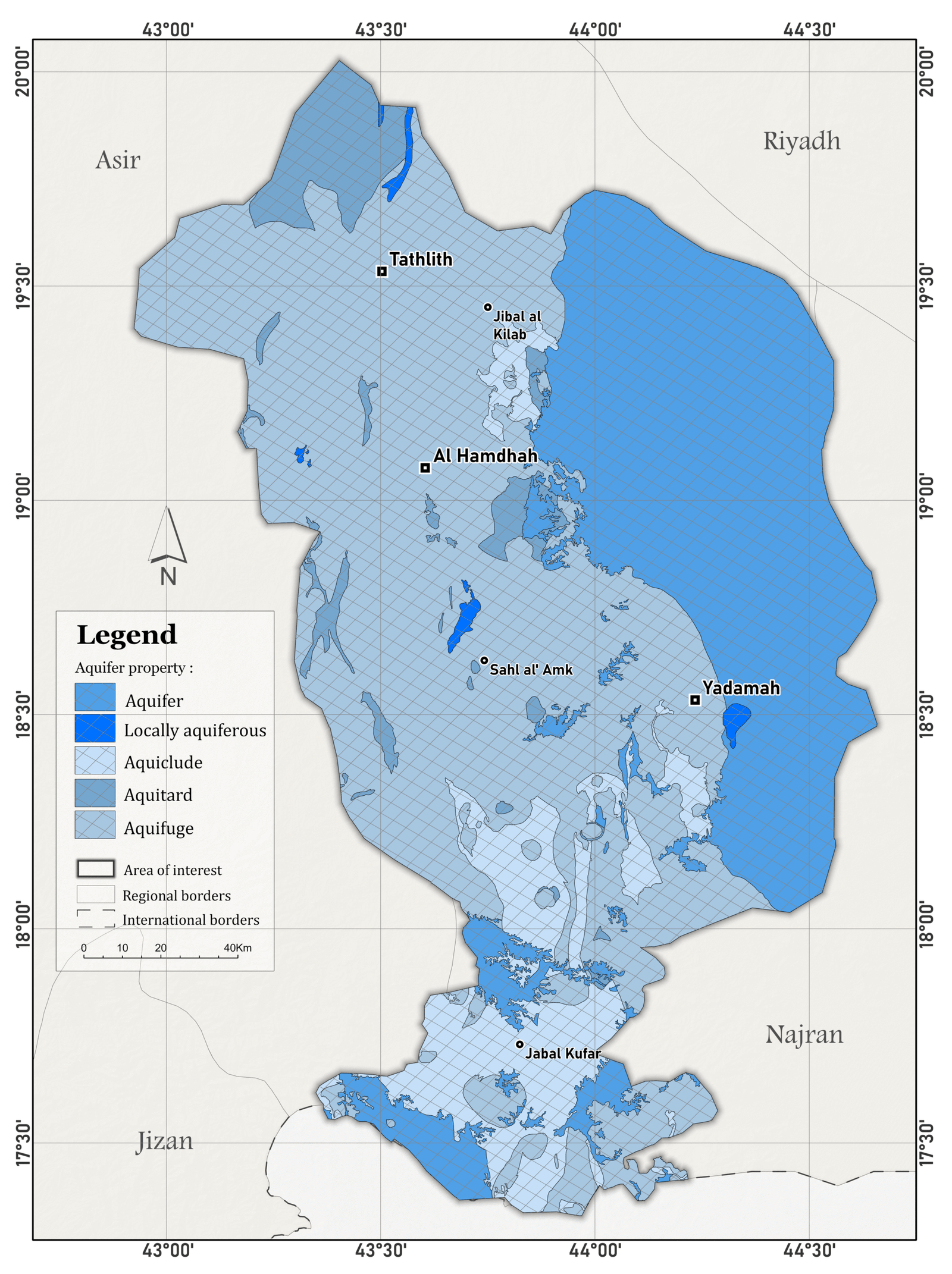
Aquifer Property of Tathlith region,Saudi Arabia
This map represents the spatial distribution of aquifer properties in the Tathlith region, inferred from lithological characteristics. Rock units were classified based on their potential to store and transmit groundwater. The map was produced using ArcGIS Pro to support hydrogeological assessments and water resource planning.
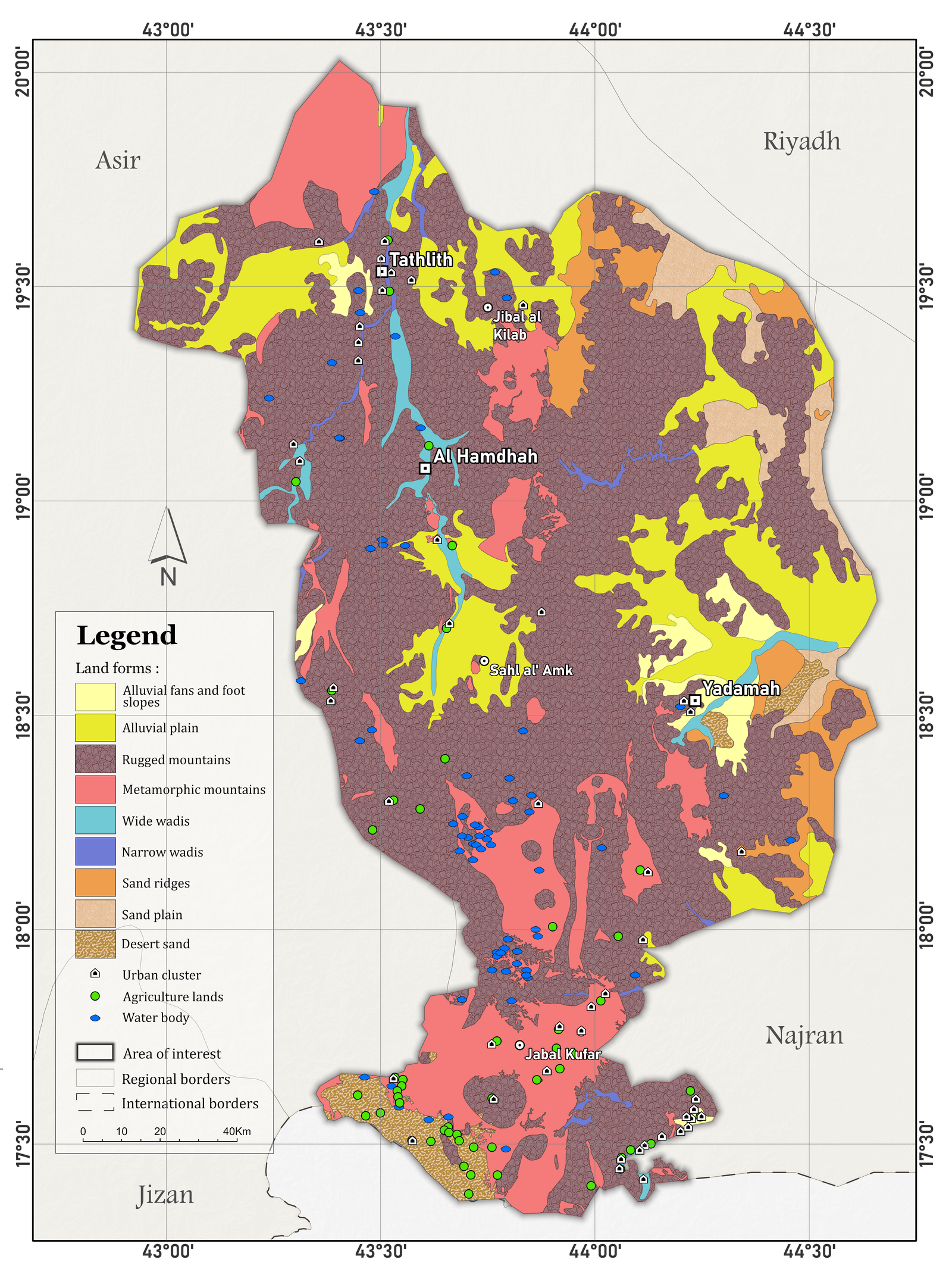
Land forms map of Tthlith region
Land forms map of Tthlith region-Saudi Arabia
This map illustrates the geology and landforms of the Tathlith region in Saudi Arabia. It was prepared and visualized in ArcGIS Pro to provide an overview of the region’s geomorphological characteristics.