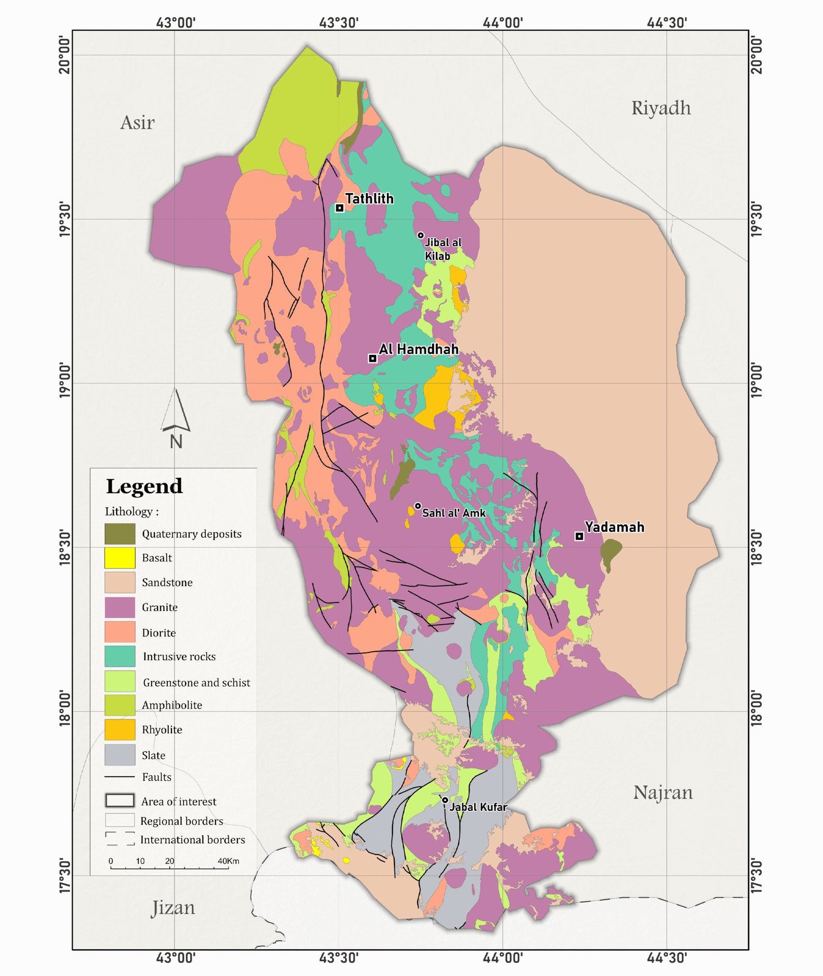
Geological map of Tathlith region, Saudi Arabia
This project presents both the landform and geological characteristics of a region in southwestern Saudi Arabia. The maps were created by digitizing features from georeferenced raster sources
in ArcGIS Pro.
in ArcGIS Pro.
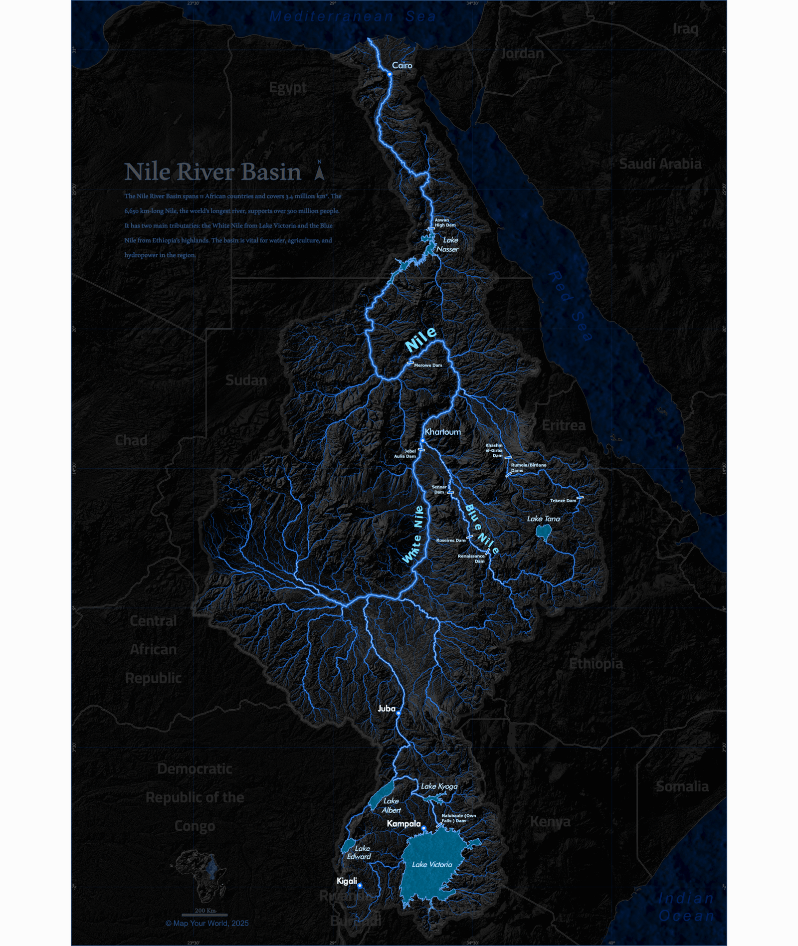
Hydrological maps
This project presents hydrological maps of selected watersheds, created using hydrological analysis tools in ArcGIS Pro, with enhanced visualization through hillshade effects and
glow style.
glow style.
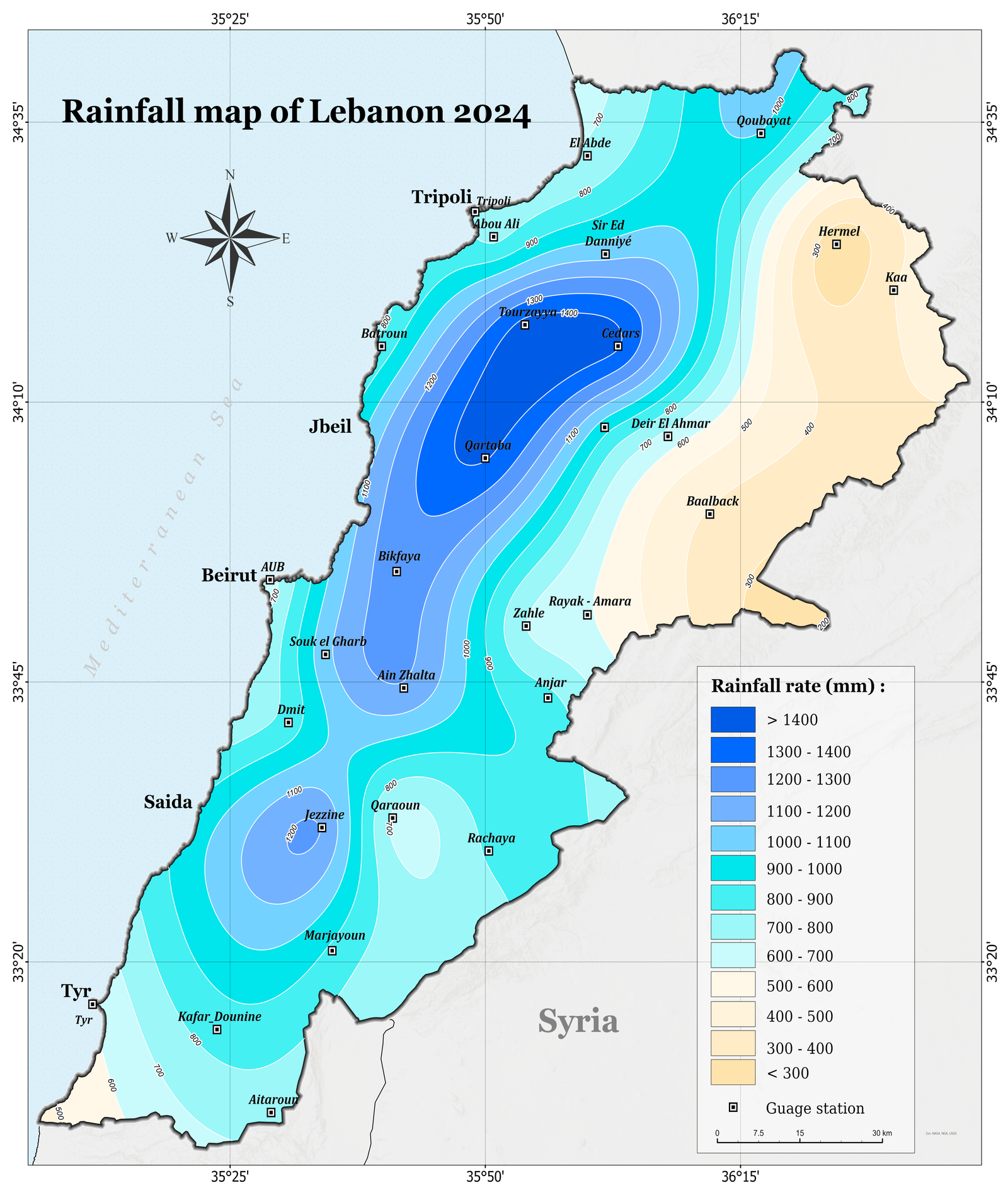
Rainfall map of Lebanon
2024
This map illustrates the spatial distribution of annual rainfall across Lebanon for the year 2024. It was developed using spatial analysis techniques in ArcGIS Pro and integrates point data from meteorological
gauge stations.
gauge stations.
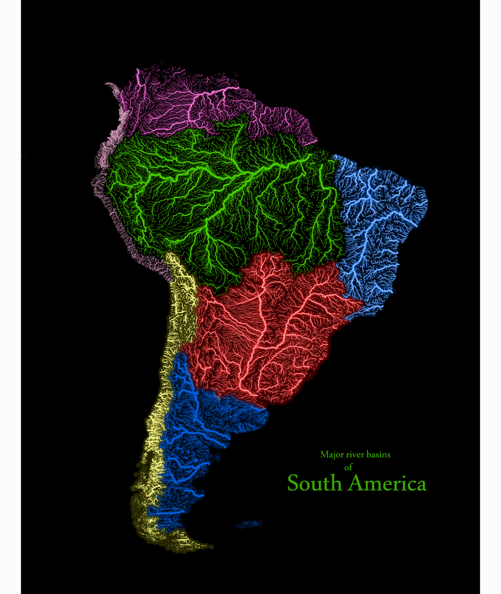
Watersheds and river networks using glow
style.
This project presents maps of watersheds and river streams, created using ArcGIS Pro. Hydrological analysis tools were applied to delineate the watersheds and extract the river networks, while glow style effects were used to enhance the visual clarity and emphasize the spatial patterns of the hydrological features.
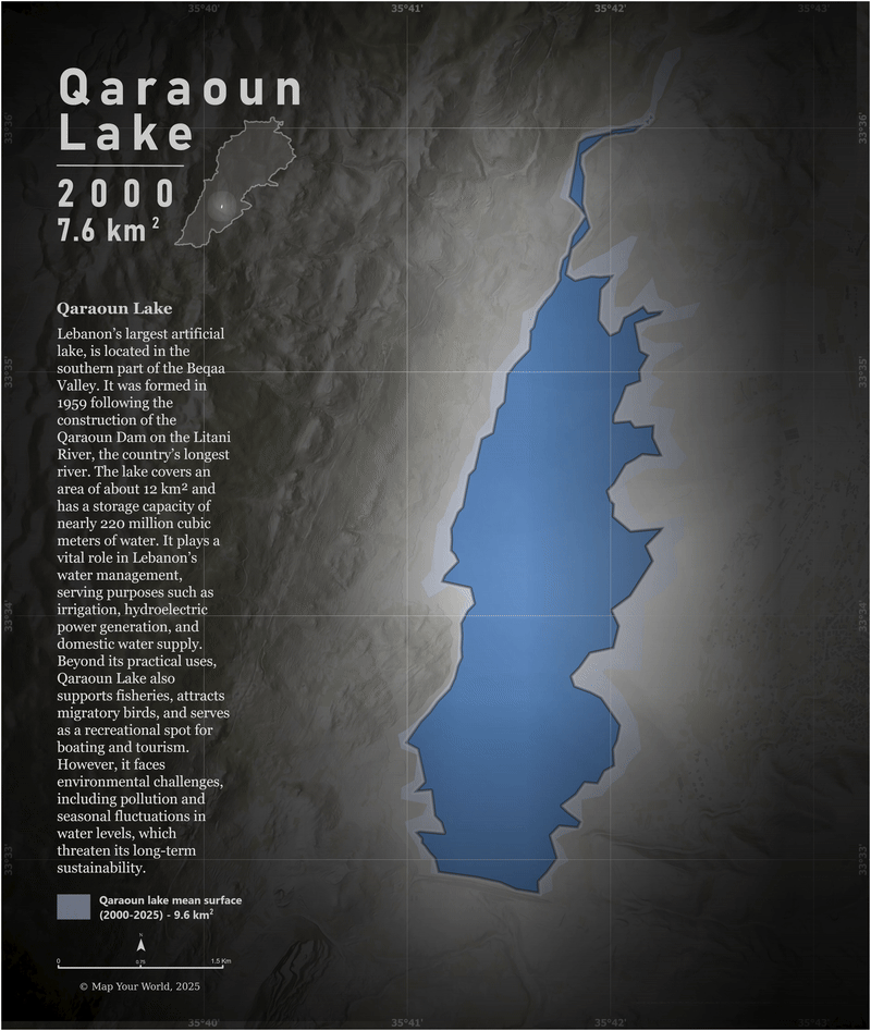
Water surface changes in Qaraoun lake , Lebanon between 2000-2025.
This project presents the water surface changes of Qaraoun Lake in Lebanon from 2000 to 2025 during the late summer, analyzed using Landsat 8 imagery in Google Earth Engine and visualized in ArcGIS Pro.
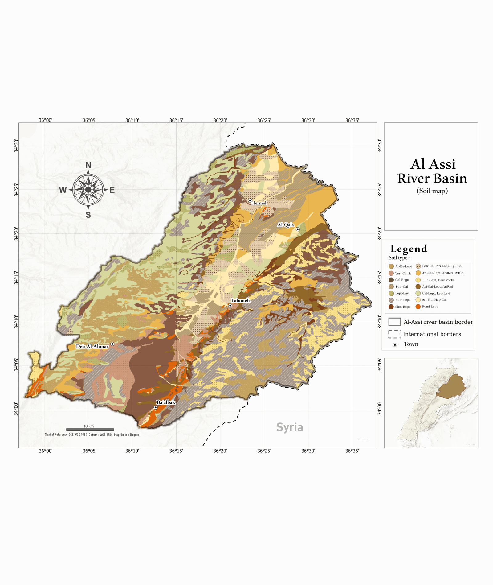
Soil map in Al Assi
river basin
This project focuses on the Al Assi River Basin, examining its physical and environmental characteristics through a set of
thematic maps.
thematic maps.

Elevation map of Lebanon using LEGO style.
This project depicts the relief of Lebanon using a LEGO-style 2D design in ArcGIS Pro. Elevation data were processed and symbolized to create a blocky, pseudo-3D effect that visually emphasizes terrain variation while maintaining a flat map perspective.

Spatial Data Visualization using Blender
This project presents a collection of maps, including relief maps and city road maps, with spatial data prepared in ArcGIS Pro and the final visualizations created in Blender, providing clear and intuitive representations of terrain and urban features.

Drainage system of northwestern Hijaz - Saudi Arabia.
This project presents the drainage system of the northwestern Hijaz region in Saudi Arabia, derived from a Digital Elevation Model (DEM) and visualized in ArcGIS Pro. Shaded relief was used in the layout to enhance the presentation of the terrain and highlight the relief features.

Drought Risk in the Middle East.
This map shows the areas of high drought risk across the Middle East, designed and visualized in ArcGIS Pro.